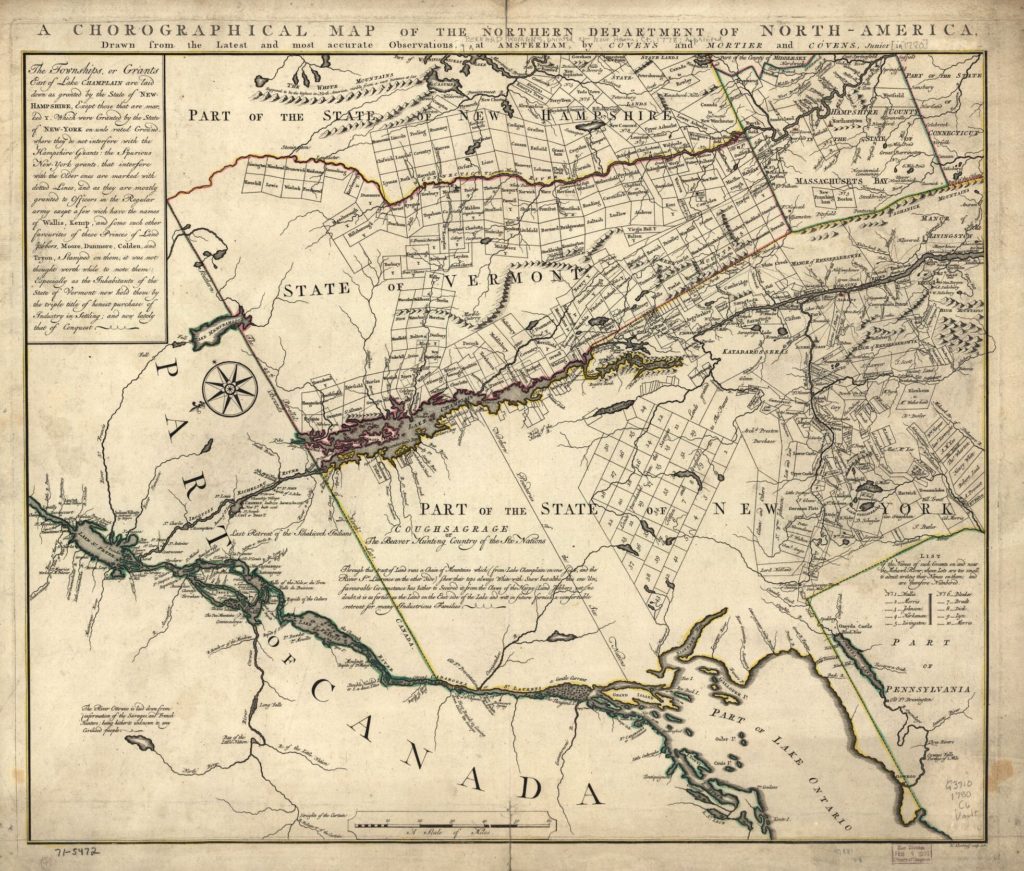
The last footnote, 162 (yes that is 162 footnotes in a 41 page article) of this scholarly essay in Winter/Spring issue of Vermont History, mentions a map, which is “…the first cartographic effort utilizing the caption “State of Vermont” to represent the landmass between New York and New Hampshire.” 1.
The map is part of the Library of Congress, Map Collection It has a strange orientation, “with north toward the lower left. Shows land grants and purchases in northeastern New York State and granted townships in Vermont and parts of New Hampshire, and Massachusetts.”
If you look carefully you will might see the Town names you recognize, but the spellings may seem a little off: Fulham (Dummerston), Westmunster, Marlborough, Hallifax, Rokingham, Brattleborough, Walpool…and further north we see Chester or Hampstead. No, these are not misspellings, but the 18th century Town names in the Republic of Vermont. Pretty cool.